


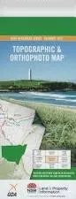
This Topographic Map is produced by the New South Wales Government.
This map is supplied in digital in PDF format, which means it can be printed at home or sent to a professional printer for a 100% scale reproduction.
At this scale, 4cm on this map represents 1km on the ground. A standard map (which is square) covers an area of approximately about 12.5km by 12.5km, with a contour interval of 10m. This map contains natural and constructed features including road and rail infrastructure, vegetation, hydrography, contours, localities and some administrative boundaries.
Muldowns Kiawarra Billabong Brockley Little Plain Trigaire North Johns Creek Amaroo Ulooma Springfield Valley The Aberfoyle Marenbah Waringa Mawarra Mylae Willow Park Brookfield Eulola Messines Mount Oak Eckersley Park Trigaire Stonefield Merindah Clifton Yarana Briarfield Glenbrook Inverness Clovelly Glen Rock Brentwood Sugarloaf Pine Tree Glenora Rockvale North Girrakool Back Creek Avondale State Forest Anthonys Gully The Back Swamp Back Swamp Creek Bakers Peak Balaclava Creek Balaclava Gully Boundary Creek Bows Creek Bows Gully Clevedon Joeys Knob Head of Lambs Valley Creek Lagune Lagune Sugarloaf Lock Abbra Lagoon Lock Creek Mount Thompson Creek Spring Creek Springmount The Sugarloaf Tableland Creek Tableland Gully Black Rock Green Hills Chandlers Peak Paddledock Paddlecock Puddlecock Puddledock


